Last summer, Erica and I tried to walk across Strathcona Park on Vancouver Island and many things went very wrong. We even got interviewed by the Sharp End podcast about our helicopter rescue.
It’s a year later. We’re still in the pandemic. And we felt like we have some serious unfinished business in the park. So once again we set off to traverse across the park.
This year’s plan
Our goal is to walk north to south across Strathcona Park by using access points that are freely available to the public. This takes us through the complex territory around Harmston and Milla Lake.
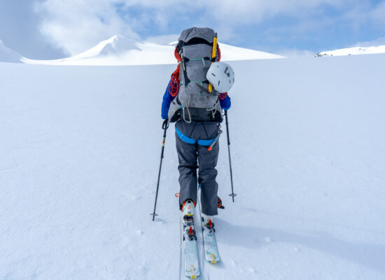
Depending on how you do it, the traverse we want to do is 80-90km over extremely challenging terrain and 6,000-7,000m elevation gain. (Mt. Everest is 8,800m tall for reference!)
Since this is a fairly obscure part of the park, I saved the nerdy map talk for the end for anyone. Scroll on down if you’re interested!
Last year, we walked from Mt. Washington to Iceberg peak. We believed that we had already tackled the most difficult terrain. Just beyond the place we got stuck, we thought things would open up and we could easily bop along Flower Ridge.
This year, we decided to reverse things and walk the other way. We started at Flower Ridge. This way we would get to this tricky technical terrain much earlier, so we could have lots of time to troubleshoot the terrain around Harmston and Milla Lake.
Here is how this second attempt went!
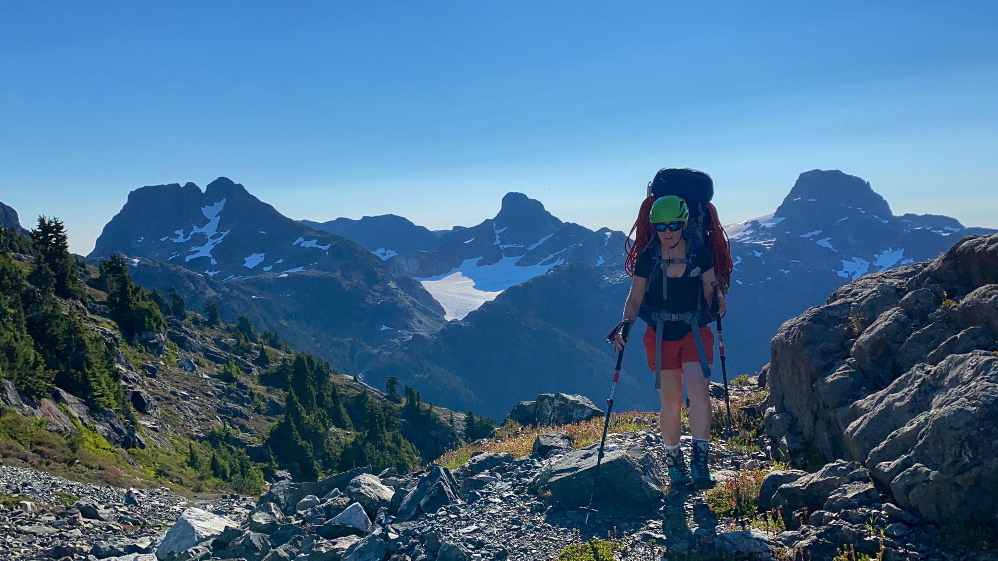
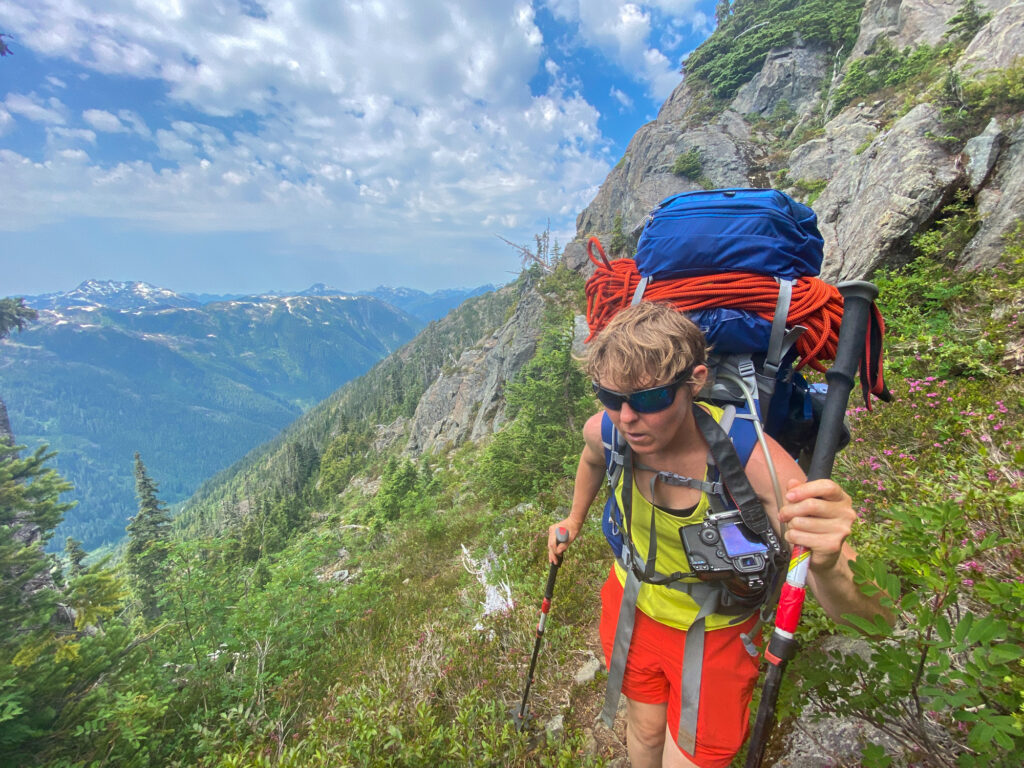
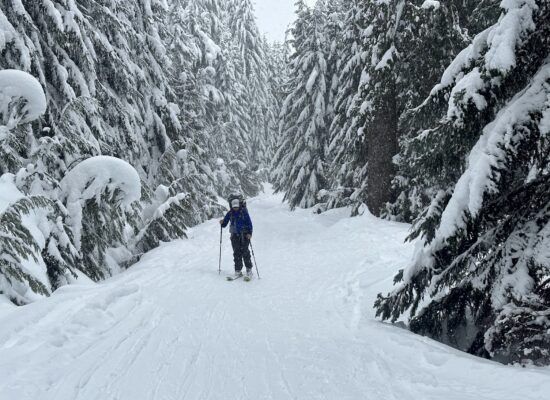
Day 1: Flower Ridge
It was a heat wave. Health officials recommended that people stay inside and limit physical activity. So naturally we loaded up 60 pound packs with 10 days of food and climbing gear and marched on up that ridge.
We got into the alpine it in about four hours, which is the time range of an overnight backpacker on a normal day. I had kept up my ultramarathon training through the heat waves earlier that summer. I really felt the difference in my fitness now. I still had to take lots of little breaks, but I was feeling strong and could keep going through the heat.
We got to the first set of large tarns about another hour or so along the trail and set up camp. Food did not seem appealing, which often happens when I exercise in the heat. I rested until I could stomach some miso soup. Once that got in me, I was able to handle some solid food. And then I could enjoy the scenery a bit more!
Honestly I see why people just do weekend trips up here. The views and camping are epic!


Day 2: Henshaw Tarn
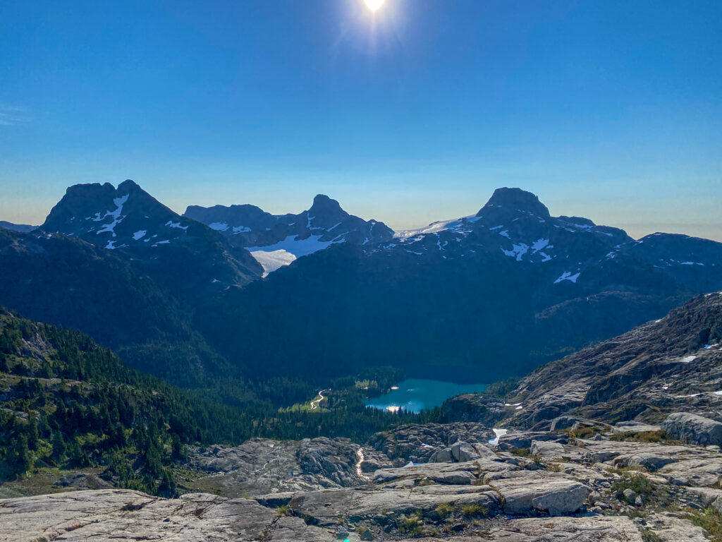
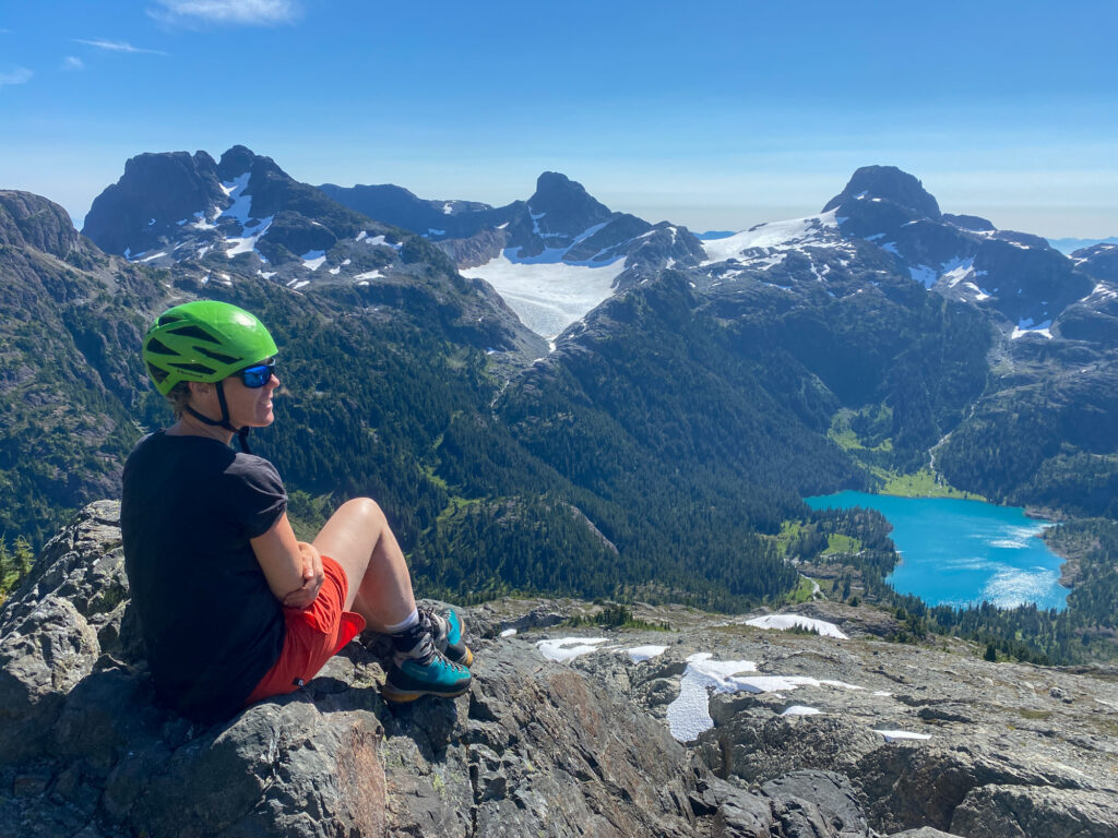
We loaded up on water and set off down Flower Ridge towards Central Crags. The terrain was gently undulating. The views of Septimius were epic!
Once we reached Central Crags, the well-trodden trail narrowed to a little path. There was a bit of exposure and careful steps on slippery dirt paths as we wrapped around the crags.
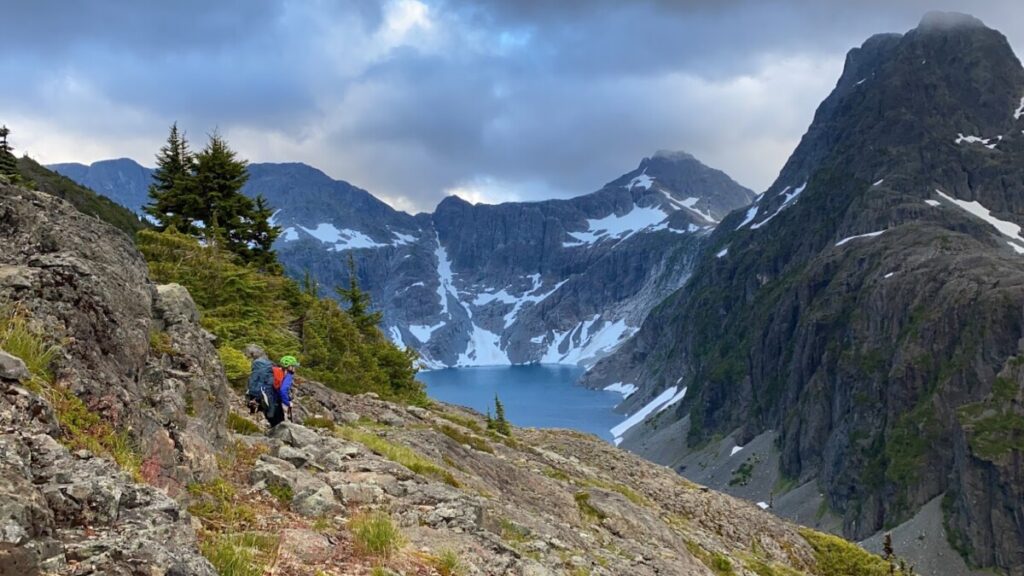
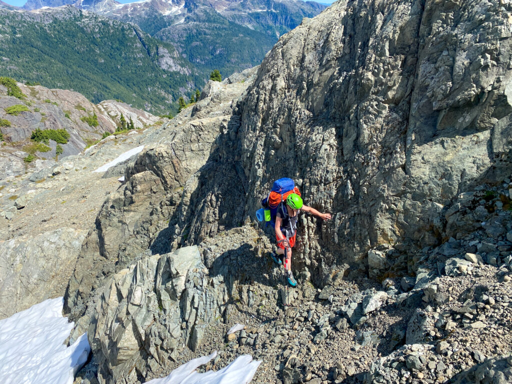
We then needed to pick our way down the mountain and head towards Henshaw tarn. This is where many hikers without navigation and scrambling experience might get stuck. There was no clear route to over the large rock formations, scree and steep snow. We just kept trying one thing and then another until we go to the bottom.
Henshaw tarn was a welcome site! It was the first time we saw water that day. Unfortunately, the tarn was full of ice. I tried to wade in for a swim, but the water was so cold it felt like it locked my Achilles heel in place. I felt stabbing pain trying to hop out of it after only a few moments.
Day 3: Shepard Ridge, almost
We were hoping we could continue to make good time and could camp at the tarn at the base of Shepard’s Ridge, if not further.
Early on in our day, we came across a very steep and exposed step. The route trends skiiers left and there is nothing but air below you which doesn’t make it feel any easier. The ground above this section was worn away, suggesting many parties had paced back and forth here deciding what to do.
Honestly, it didn’t look that difficult past the first move or so. But it required you to lower your entire body down to a lower step with no decent handholds. And we were not going to be able to do that with fully loaded expedition packs.
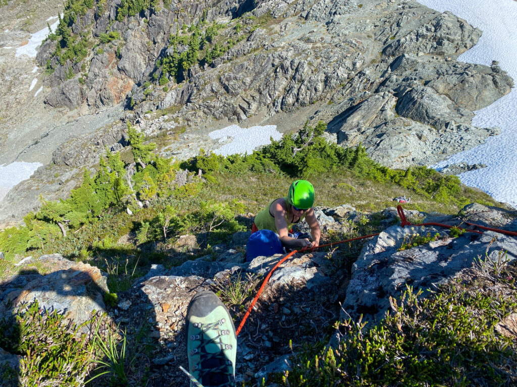
There were a few old trees at the top. I didn’t want to trust my entire weight to them and rappel. A handline seemed like the best compromise, so I set one up.
Honestly, that took a while. Maybe an hour and a half or two hours. I had to figure out what to do, do it, and then take it down. And I started feeling really frustrated with how heavy our packs were. This terrain would be easy for me if I wasn’t carrying seven days of food.
We kept moving as quickly as possible down to the lowest point of this route along the ridge. Then we immediately had to start heading up again. It was hot and the sun was beating down on us. I could only walk for about 30 minutes up the steep terrain before I started feeling nauseous and needed to take a break in whatever little pockets of shade we could find.
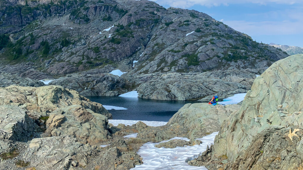
At the top of this part of the ridge, the terrain changed from grassy meadows to granite blocks and steep snow. We found a random tent pad, far from water, where someone must have given up for the day. It was getting near dinner time, but we kept pushing on.
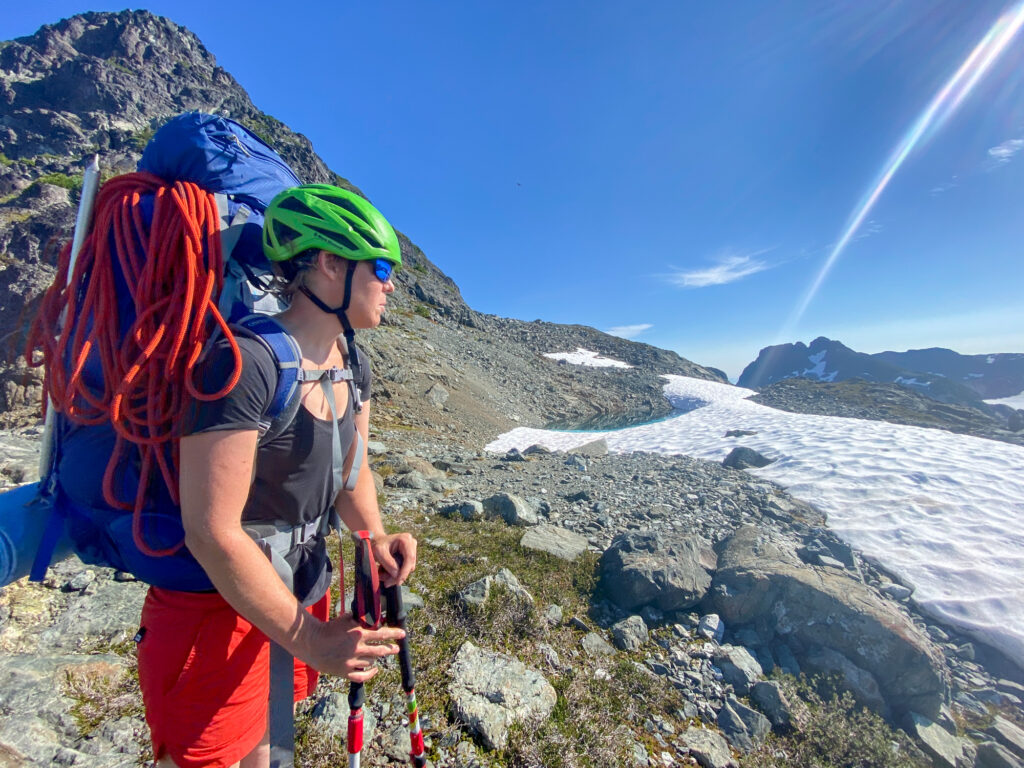
When we got to the top, I examined our new view. I saw the area we wanted to travel through for the first time. It was more complicated than I had imagined.
I could see how we would need to go very far down towards the valley floor and back up again several more times. Then there was the Lower Cliffe Glacier which we had wanted to travel across, but it was steep and bare ice. I could see how heavily crevassed it was from far away.
We slumped near a little tarn, trying to recover from the last push and process what we were seeing.
Erica said, “Well, I’ve camped in worse places!” I got upset. I tried to push her to keep going.
But after checking our maps again, I realized just how much farther Shepard’s Ridge was. So we pitched our tent next to our humble tarn at the top of the ridge.
Day 4: Another forward push
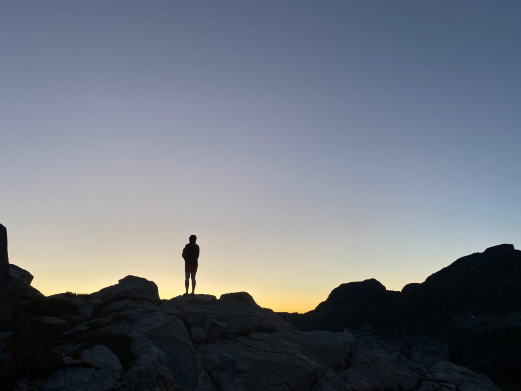
It felt sad that night despite the stunning sunset and gorgeous mountain views. I felt fairly certain we would not be summitting Harmston. And we would not be crossing over to Reese Ridge.
We woke up deciding we’d try to push as far ahead as we could, at least to gather information for next step. We scrambled down once again and up once again.
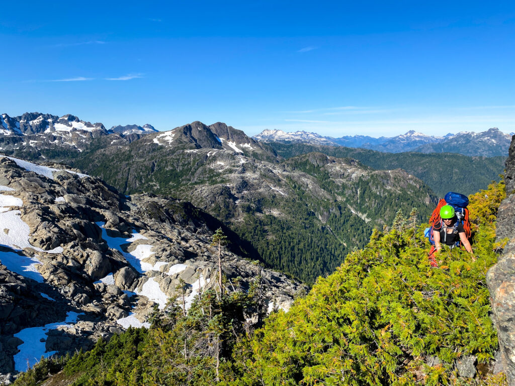
We had some classic island bushwhacking. Are you scrambling on rocks or climbing trees? Who knows.
Then we arrived at the base of Shepard’s Ridge, where we had hoped to reach yesterday. It took us two hours that morning.
We decided to take our packs off and serious consider our options:
- We could continue heading towards Harmston and keep trying our traverse.
- We could try to leave via Shepard’s Ridge.
- We could turn around and leave via Flower Ridge.
Continuing ahead towards Harmston did not look appealing. The terrain right ahead of us was the most difficult of the trip. We also had very little information, as so few people travel in this area. We were not confident we would be able to get through it at this pace. We were also running out of days to backtrack if we got stuck.
Shepard’s Ridge was also a fine alternative. We had already covered the majority of the terrain. That traverse was a worthy objective in it’s own right! It’s called the Henshaw Horseshoe. There is a high route that involves some tricky scrambling and steep snow on across glaciers. Given that we still had heavy packs and six days of food with us, this did not sound appealing.
So we set off on the less travelled low route around Shepard’s Ridge. We even had GPS tracks! How hard could this be?
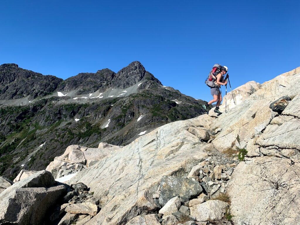
The snow was so low that every bit of forward momentum was extremely challenging and time consuming. There were steep slopes of scree covered in talus, which is dangerous and unpredictable. We had to climb down steep granite blocks, edging with our mountaineering boots.
A few hours later, we realized this route was not feasible for us right now. We had to painstakingly retrace our steps back to Shepard’s Ridge tarn.
This left us with option 3. Turn around.
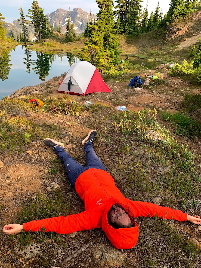
We were emotionally exhausted at this point. Erica was determined to go beyond our last camp site for morale purposes. So we hiked and scrambled as fast as we could, reversing what we did that morning and part of what we did the day before.
We finally settled near dark in a bumpy camp with another sad little tarn. I accidently ended up sleeping a giant rock under me, which I padded around with the clothes I wasn’t wearing.
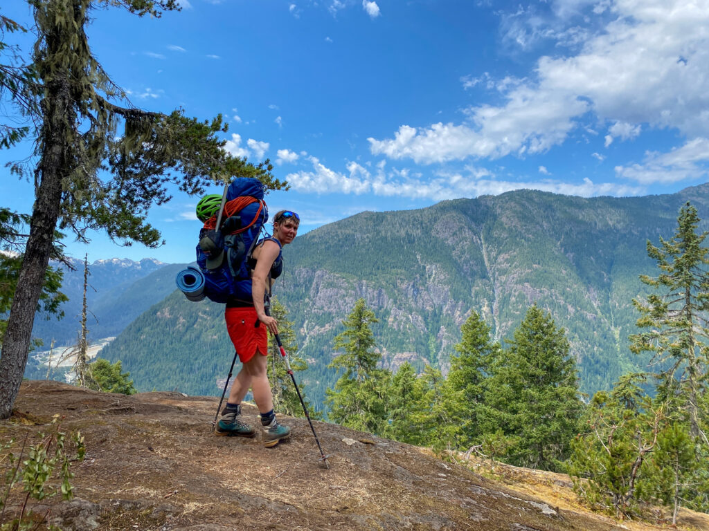
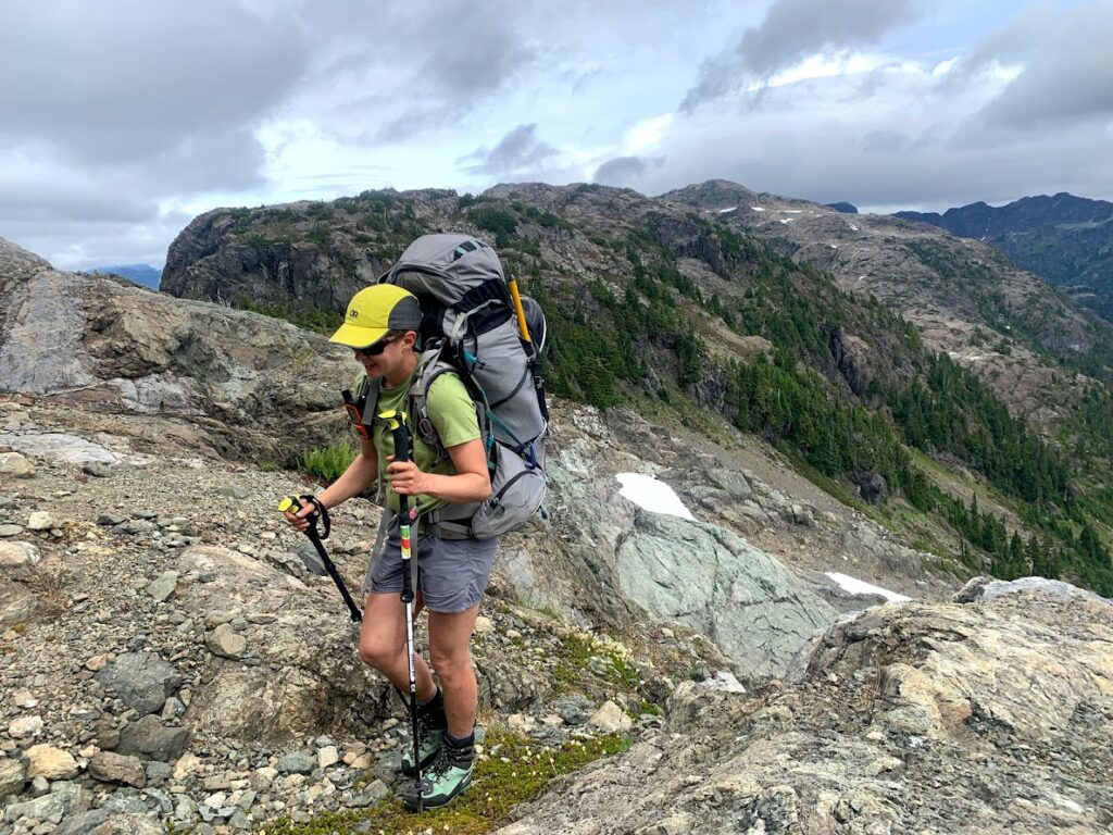
Day 5, 6, and 7: We tracing our steps
We slowly made our back out via Flower Ridge. We took our time, slept in, hiked shorter days. We processed what had happened.


Yet again, this traverse had shut us down. It was humbling to realize just how out of our depth we were last year. We always told the story as if Erica injuring her knee or getting stuck at the cliff edge during the downpour is what kept us from finishing.
However, even if we had somehow been able to keep going, we would not have made it out in time. We had days and days of travel ahead of us at the pace we had been going. We simply were not moving fast enough.
I was proud of our decision making this time around. It’s a less interesting story, because nothing epic happened. But we returned safe and we did not need to bother Search and Rescue!
Lessons learned
Two times now, we’ve tried to approach this traverse in the same way, as an expedition.
We are strong and can carry huge packs for long days. But we cannot move quickly over this terrain. And we slow down to a crawl in fourth class terrain.
As we hiked out, I told Erica we need to get fitter and we need to carry less stuff. But I didn’t know how that was possible.
I was already training for a ultramarathon. How much fitter could I realistically get? A little bit more every year, for sure. But not orders of magnitude faster.
Erica said everything we had packed was essential. I agreed! Or else I wouldn’t have packed it.
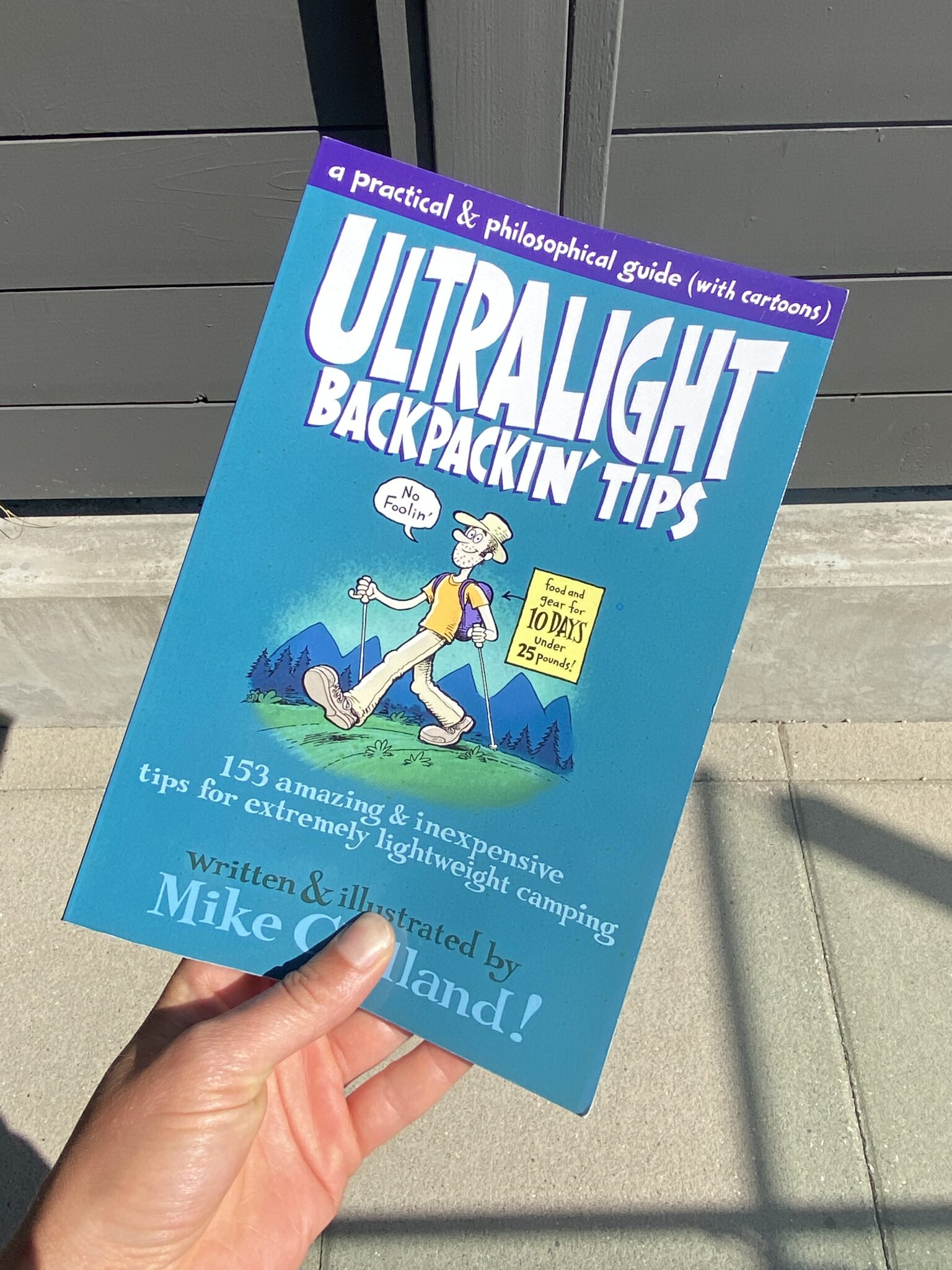
However, a few days later, we spotted a book on ultralight backpacking at MEC and I decided to buy it. Little did I know this would totally change how we approached backpacking.
And for that story, you’ll have to wait for the next blog post!
How to make your next adventure a safe one
We left a detailed trip plan with a friend, including instructions on when to call 911 if we didn’t return on time. We also carried a Garmin Inreach that we could use to call for help in the field. Given the remote nature of the trip and length of time we were out there, we considered a satellite communication device essential.
We wear lightweight helmets the majority of the time we are in terrain like this, which involves scrambling and hiking up steep ridges with loose rock. Sometimes we take them off when we are in open terrain with nothing above us and no risk of falling. But honestly sometimes we forget. They are very lightweight and don’t usually bother us.
We carried a rope, crevasse rescue gear, harness, ice axe and crampons to navigate the Cliffe Glacier. We didn’t reach the glacier, so the gear mostly just went for a walk. It happens sometimes!
The nerdy map talk
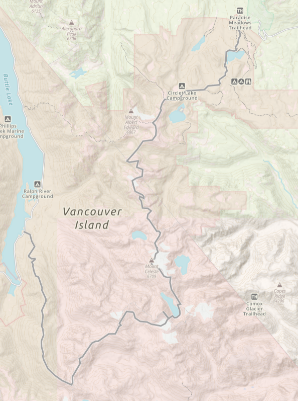
Again, our goal is to walk north to south across Strathcona Park by using access points that are freely available to the public.
This means you start at Mt. Washington or Auger Point. And then you can exit via Shepard or Flower Ridge. This route will take you past by many remote and stunning areas including George V, Siokum Mt, Reese Ridge, Mt. Celeste, Iceberg Peak and Mt. Harmston.
We also want our traverse to go through the complex terrain surrounding Mt. Harmston and Milla Lake. People approach this area every year from multiple access points. But very few have ever walked from the north to the south, down Reese Ridge, around Milla Lake and onward towards Flower Ridge.
In all my research, I have found one party that traversed through this area in 2018. I also know of a second party that also travelled through this area many years ago before the glaciers shrunk. There are likely others, but it’s not a route that people take very often.
If we got access to the locked logging gates, it would make the traverse much easier by making it shorter. But we’ve decided these routes are off limits for this project. This means we cannot start or end via Kweishun Creek or Oshinaw Lake — the traditional and shorter routes to Harmston.
This started as something easy to do close to home during the pandemic. But it’s turned into one of the hardest things I’ve ever tried. Something that is pushing not just my physical limits but making me rethink how I approach mountaineering in general.
Discover more from We Belong Outside
Subscribe to get the latest posts sent to your email.
One thought on “Traverse Take Two: Flower Ridge Towards Harmston And Tzela Lake”
A wonderful description of a beautiful area. I remember that steep down climb just past Henshaw being tough as well! I like your humility and safe choices when confronting difficult terrain.
I look forward to reading more of your adventures.