
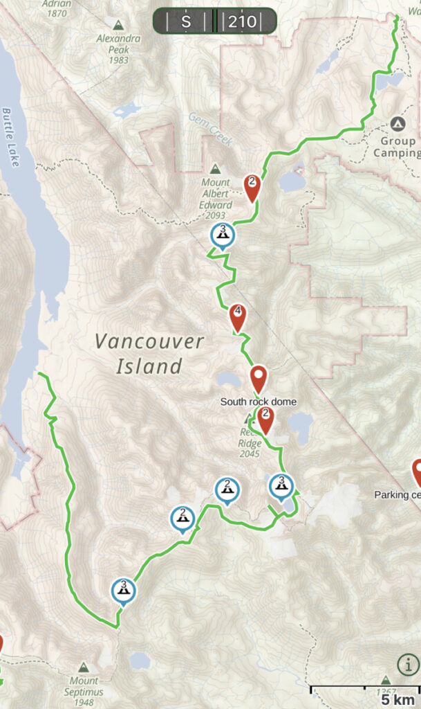
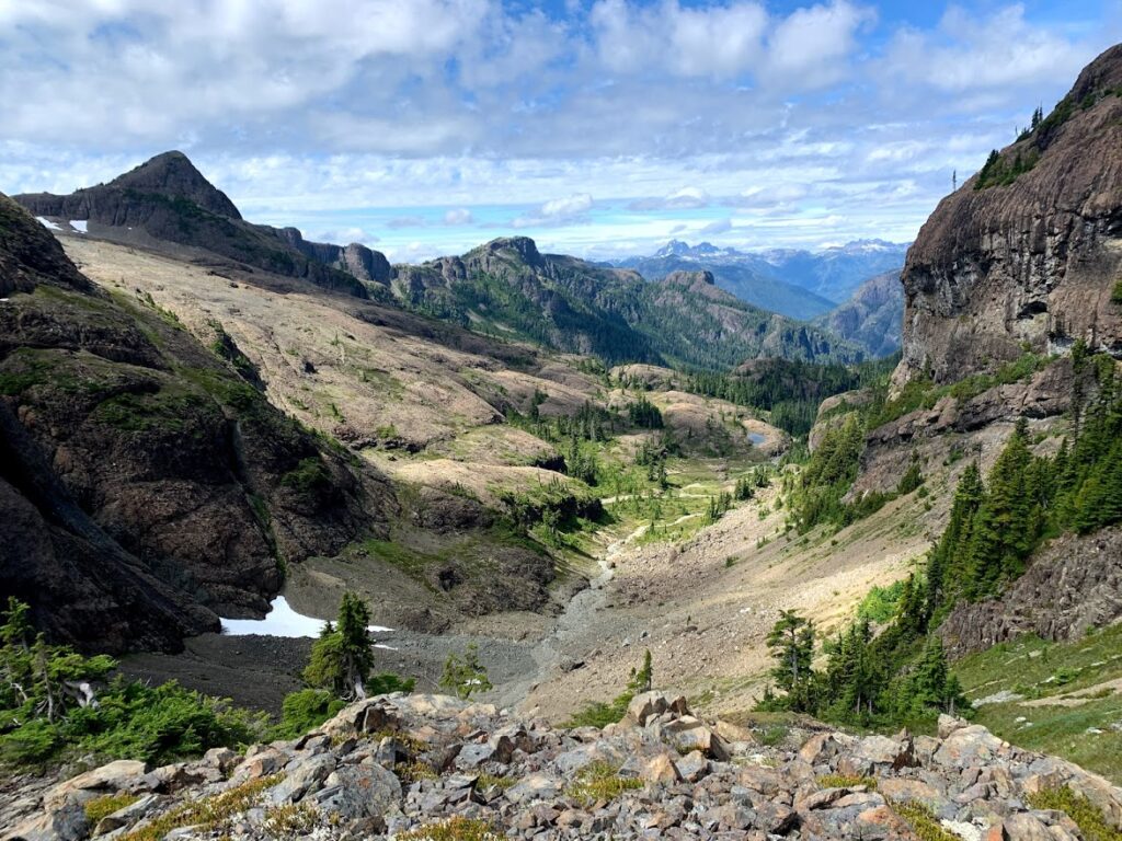
We set out to travel 80km from Mt. Washington to Flower Ridge over eight days. Our goal was to climb eight of Stratchona Park’s tallest and most remote mountains. This included Harmston, one of Island Qualifiers.
I wanted a trip that was physically demanding but less scary than my usual mountaineering trips. COVID stress left me feeling so drained. I just didn’t have the same appetite for adrenaline that I usually do.
But endurance events were still very appealing. I was looking forward to working through some stress by spending some long days carrying a heavy pack.
Day 1
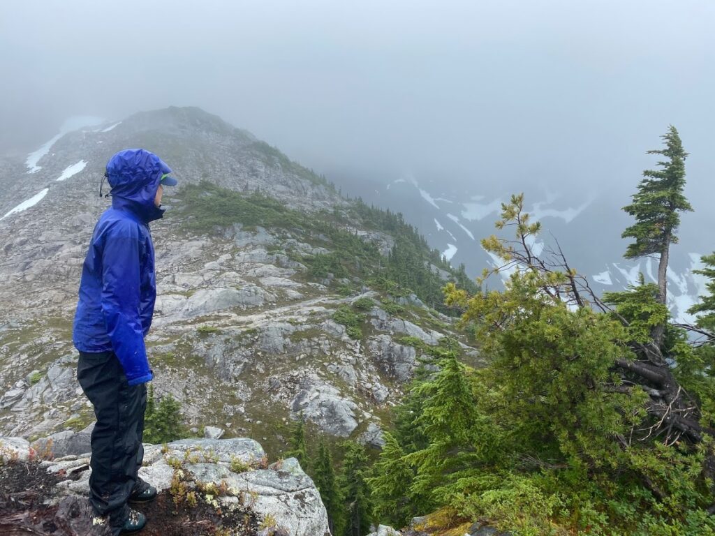
On our first day, people stopped to chat with us on their way down from Albert Edward. They saw our ice axes, crampons and rope and wanted to know what we were doing.
Some told us we were hardcore. Others said we had the wrong gear or weren’t going to make it. There were two guys ahead of us with similar mountaineering gear. I did wonder what types of conversations they were having!


We didn’t get as far as we had hoped on the first night. Up on the ridge there was bitingly cold wind, rain and low visibility. We just didn’t feel like pushing it in these conditions on day one, so we settled in before Mt. Frink.
Day 2
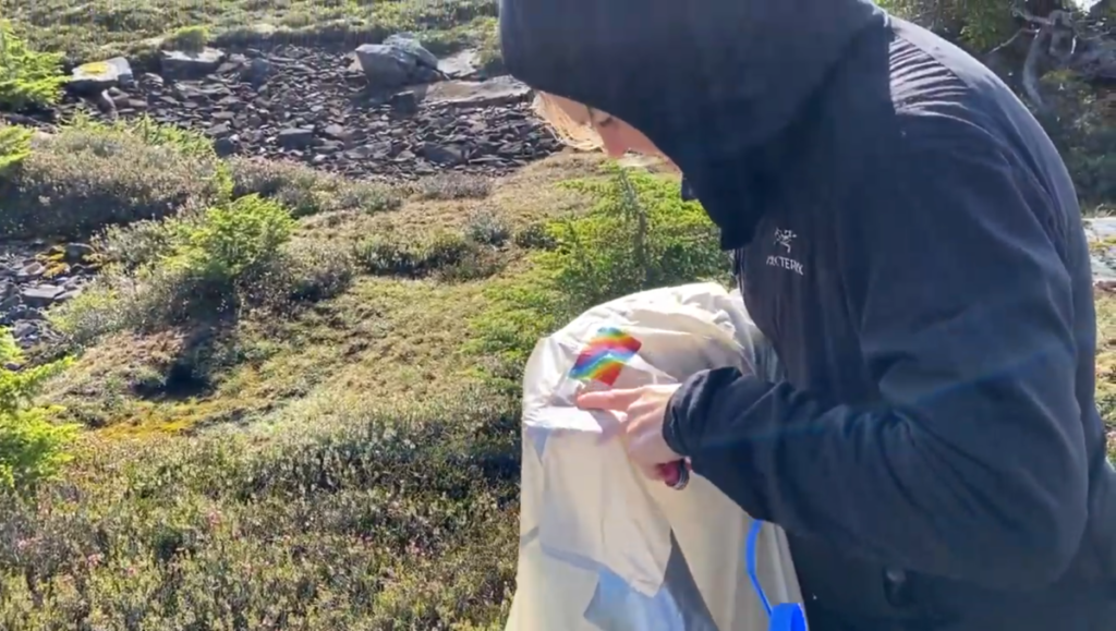
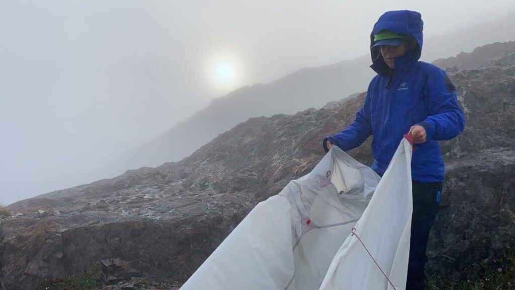
The next morning, I made a rookie mistake. I took the tent pegs out before I took off the fly. A little gust of wind came by and sent our tent off flying like a kite. I dived and saved it from rolling down the ridge.
I ended up a little bruised. And so did the tent. It was full of holes.
We had enough duct tape to seal up all the rips. We both were carrying a lot of emergency repair tape! First crisis averted.
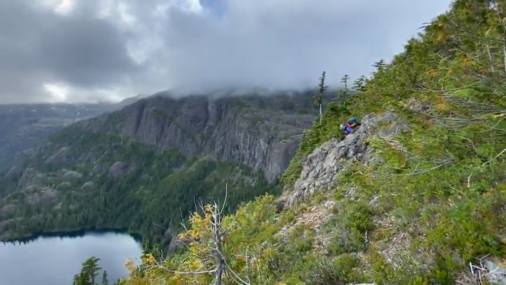
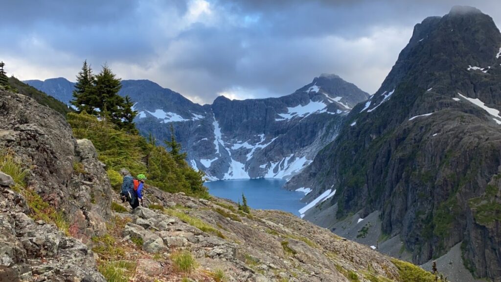
Our first stop that day was Mt. Frink. This is one of the three mountains on the popular Albert Edward and Castlecrag circuit. After a snack on that summit, we searched to find the right spot to climb on down the backside of it.
It was a gateway into a world where hardly anyone goes. We left the crowds and rock carins behind. It was just us now!
Before we left home, we had made our own GPS track in Google Maps. We carefully studied the guidebook, maps and satellite imagery. We then drew a line on Google Earth where we thought we’d want to go. We then saved this track into our GPS program that we’d use on the hike. And that’s what we were now roughly following.
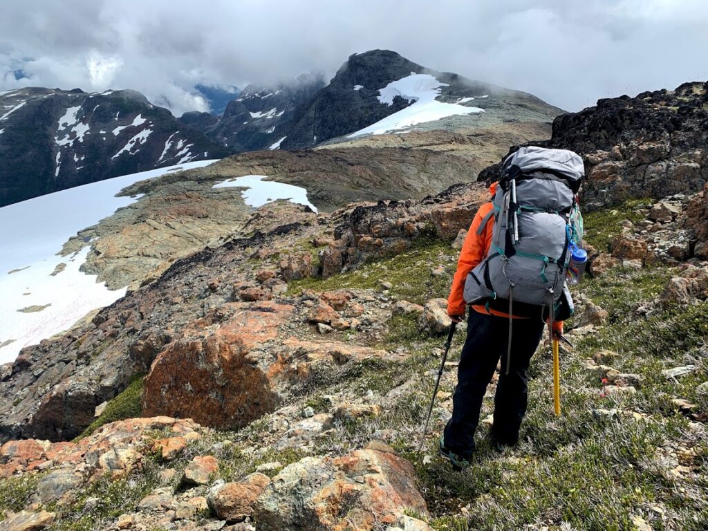
We were a bit surprised by just how steep the terrain was right right away. As a climber, I didn’t feel very scared. But I had to take my bag off several times.
My bag weighed about 45% of my body weight. This is hard to manage in the best of circumstances, let alone an exposed scramble.
Day 3
Today we had to climb three of Vancouver Island’s tallest mountains to stay on schedule. First up, Mt. George V.
We were about to get an introduction to just how hard the navigating was going to be.
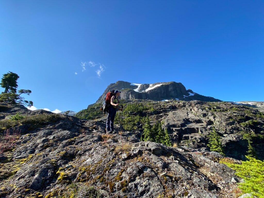
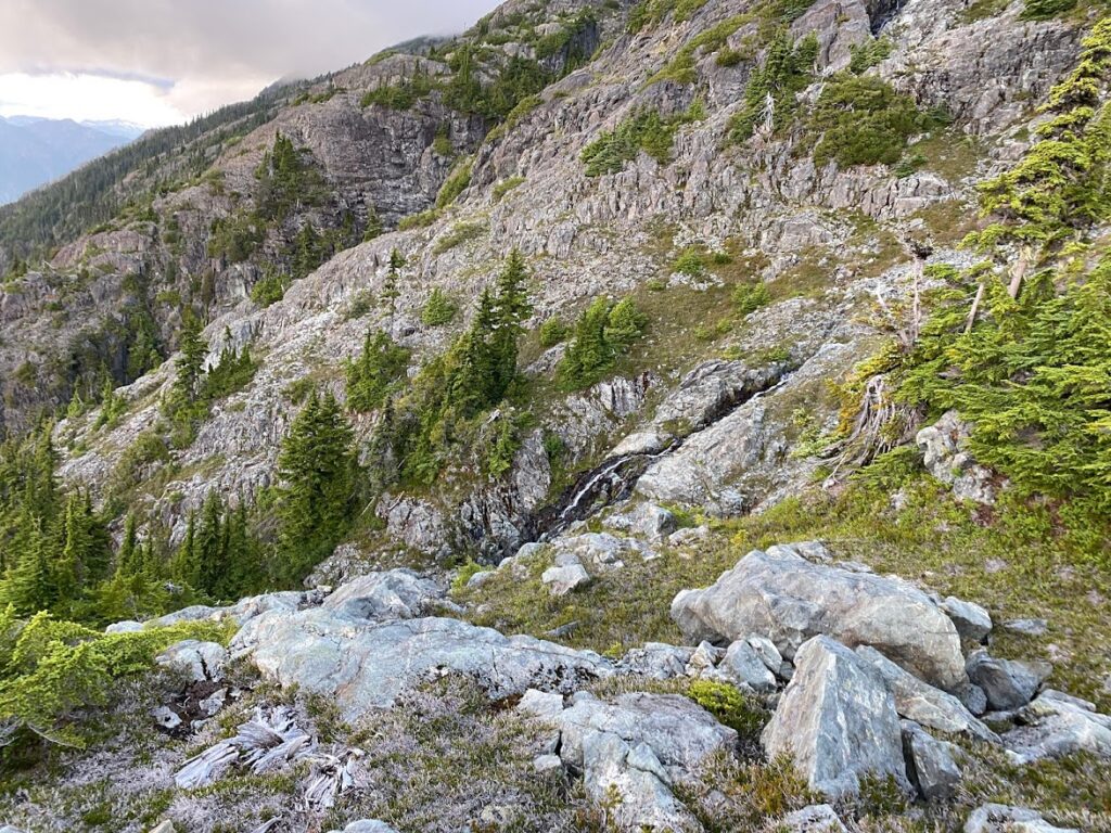
The guidebook gave us a GPS coordinate to aim towards, but there were a lot of trees, cliffs and snow between us and it. But Erica picked a great line. We ended up climbing alongside a waterfall. And then we picked up a flagged trail to the summit.


There were only a handful entries in the summit register dating back to 2008. We were the second party that year!
Two more mountains to go that day. They were just named after their elevation: 1920 and 1909. Since we were already up so high, 1920 was a little hop and a skip away.


As we were coming down 1920, we had the scariest moment of the trip. We were carefully making our way down a talus field. (Talus is rock debris between the size of a pebble and a boulder.)
We were so careful not to knock rocks on each other. We had our helmets on. But a full 20-30 minutes after we were off the steep part, three rocks came hurling down at us at top speed. The must have been disturbed earlier but just now started to roll down the hill at us.
I heard them first. When I saw what was happening, I yelled ROCK and pushed Erica in a safe direction. I ran to safety. To my horror she ran the other way, towards the rocks.
I watched as those life-ending rocks zoom by her. I actually thought she had been hit, as she stumbled backwards. But it was just from the shock of the whole thing.
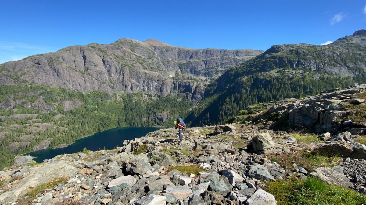
We were pretty shaken up, but had to keep going to get to our campsite. At the bottom of the ridge, we got drank some freshly melted snow, layered on the bug spray and marched on over to the summit of 1909.
It was a fabulous campsite with great views and a lovely big tarn that we swam in.
But that night I had a hard time sleeping. I kept replaying those rocks getting so close to Erica.
And we were getting deeper and deeper into the park. More and more alone.
Day 4
The next morning, we carried on down into the Siokum River valley. This was marked as challenging spot for navigation in the guidebook.
We carefully scanned our route for signs, like flagging tape or rock carins. We saw lots of worn heather and bark rubbed off branches, which we took as a good sign that others had been there before.
Then I saw clear hoof prints in the dirt. We were following animal trails, not people at all!
This just made me so happy. I know that people often follow game trails, this was not a new concept to me. But it just sunk in that moment just how few people venture this deep in the park. It was just us and the elk.
This was the hottest day so far. And the mosquitoes were so fierce, no amount of bug spray would keep them off of us. Erica’s face was starting to look like she had chicken pox from all the bites. She layered up in a warm jacket, hoping to stop the bites.
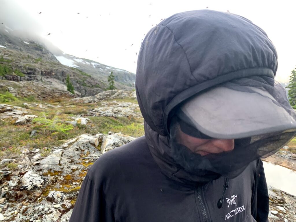
I overheat easily, so I couldn’t do this. So put on my little bug head net, took off my jacket let the bugs feast on my arms.
I think marching uphill in these conditions is one of the hardest things I’ve endured on a trip. I felt nauseous and lightheaded from the heat. My arms were stinging from me smacking at the bugs. And my ears started to burn from all the bites. Even though I was protected by deet and a bug net.
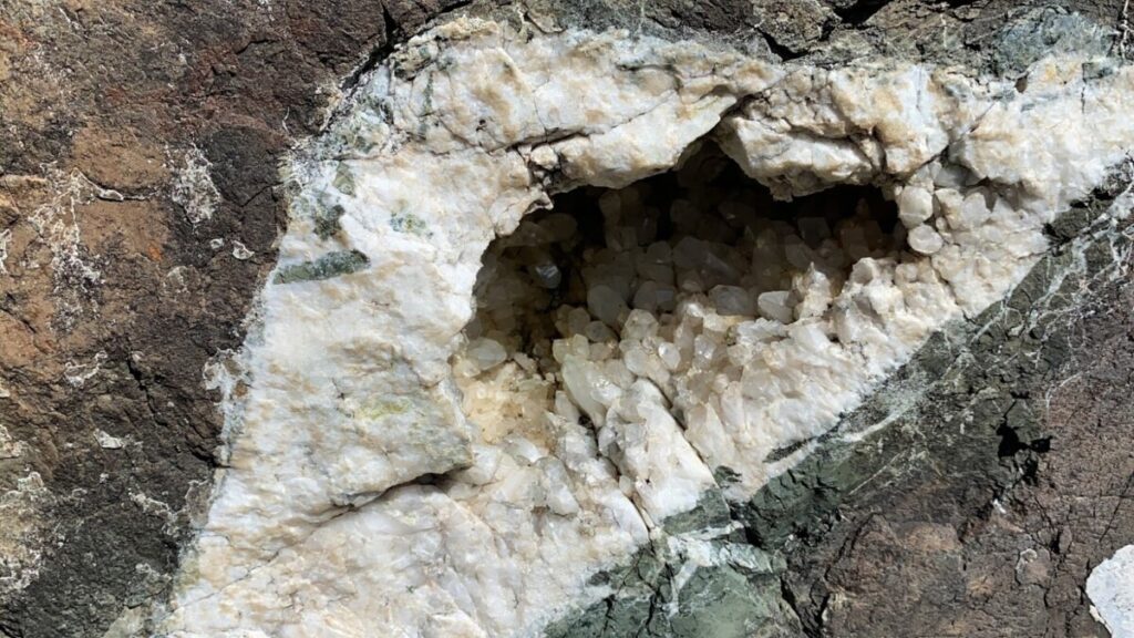
There were really cool geodes and crystals everywhere, so this kept me going. And lots of snacks and water breaks.
Next thing I knew, the mosquitoes stopped. We had been transported to Mars … or a version of a Mars with snow.
We navigated our way through these bumps. At one point the game trail we were following headed off into some thick trees. And then who knows where? Off a cliff?
I didn’t want to go into the trees, but Erica yelled, “I’M A BEAR!” And off she went. I followed shortly after.
We were going a bit … feral.


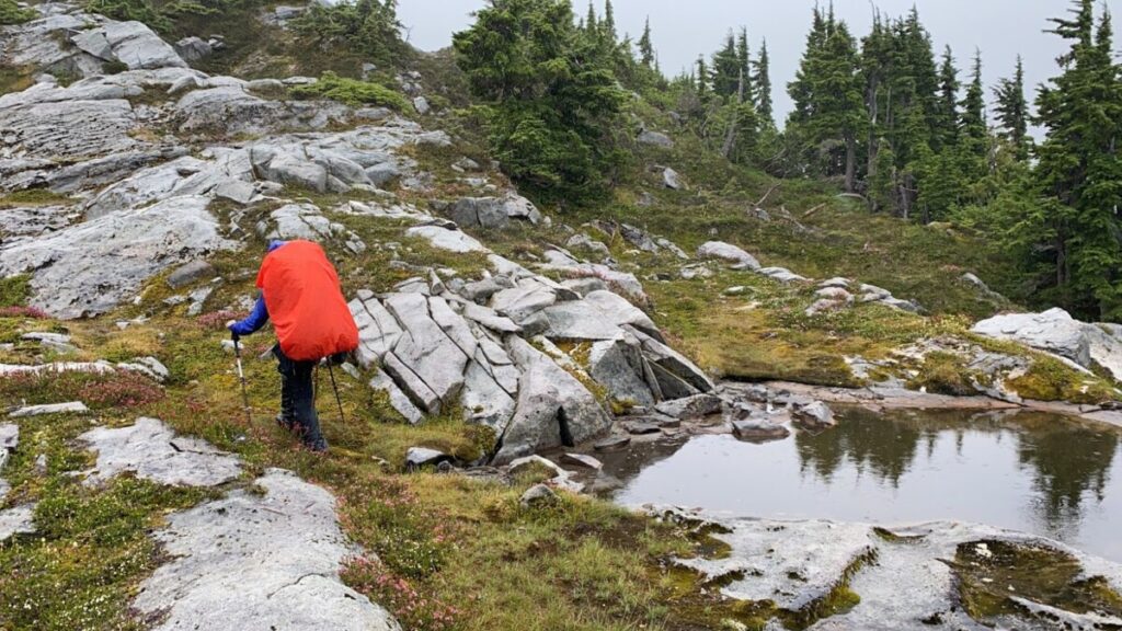
We hit another route finding challenging around 7:00pm, so we decided to camp. We spent our last hours of sunlight scouting our route for the next morning.
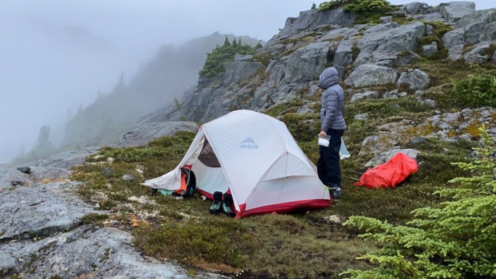
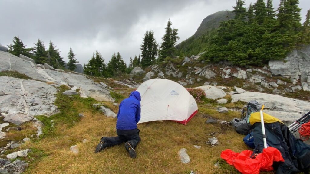
We then pitched our tent in the most sheltered spot we could find. It was a good call, as that night we had the worst storm of the trip.
It was pouring rain. The wind pushed our tent walls from side to side. I kept getting up to check our duct tape. Everything was dry. Whew! But the Hubba Hubba tent walls were flopping around in the wind, despite being very securely stake down. Perhaps we had reached the limits of our three season tent.
Day 5
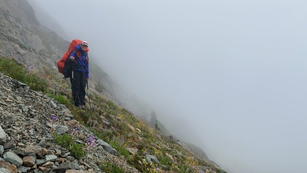
We woke up to another whiteout. Sigh. Love navigating in whiteouts.
Our route finding the night before was very helpful, as we had a fairly good idea of which gully to drop into.
After the gully, we ran into a little trouble. We climbed up this rock ridge. We saw a lot of nibbled bark and a cozy little resting spot under a tree. We figured the animals we were following had gotten stuck somewhere along here. And sure enough, our route ended in a cliff.
So we just turned around and tried another way. We were only set back by an hour. Not a big deal! And we had made it to Rees Ridge.
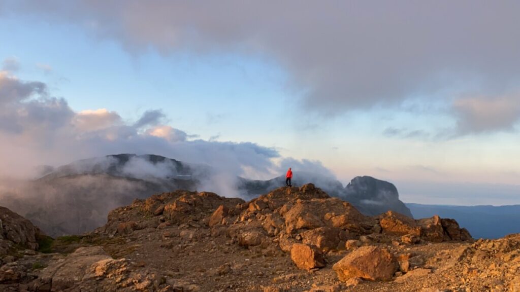
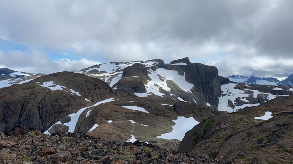
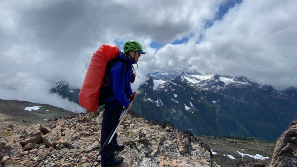
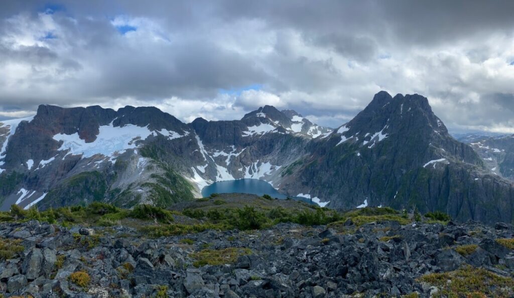
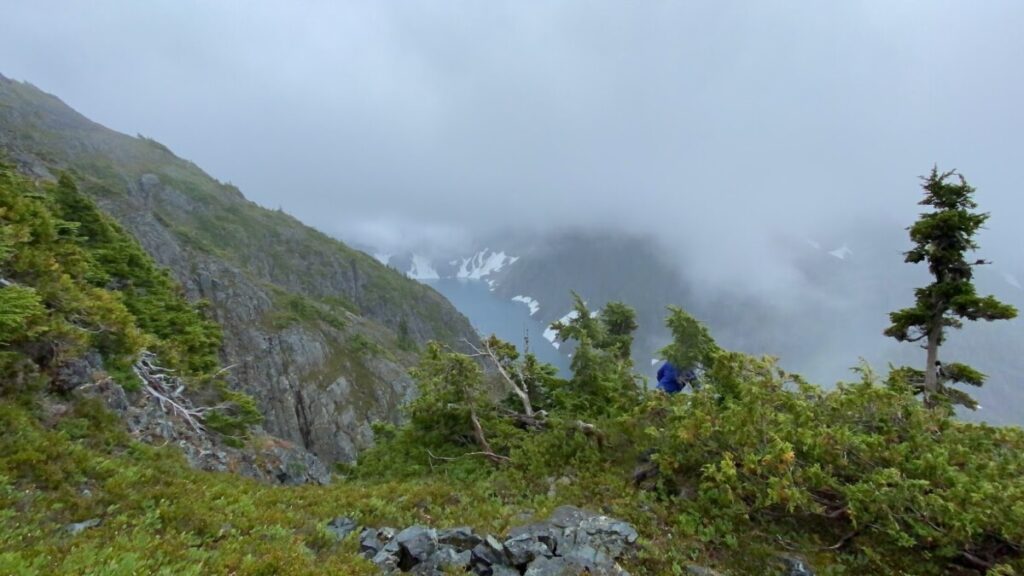
Rees Ridge was the whole reason I was here. It’s very hard to get to and has two of the tallest mountains on the island. I was so excited for the views.
Unfortunately, when we arrived it looked like this:
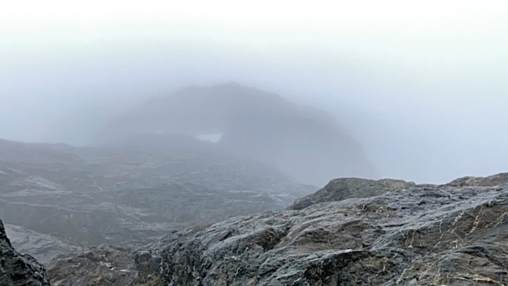
Sigh.
But navigating on snow in a whiteout seems to be my specialty. We didn’t know if the rock or snow way would be better, but I took at the maps and the photos from the day before. And I picked snow. And up we climbed.
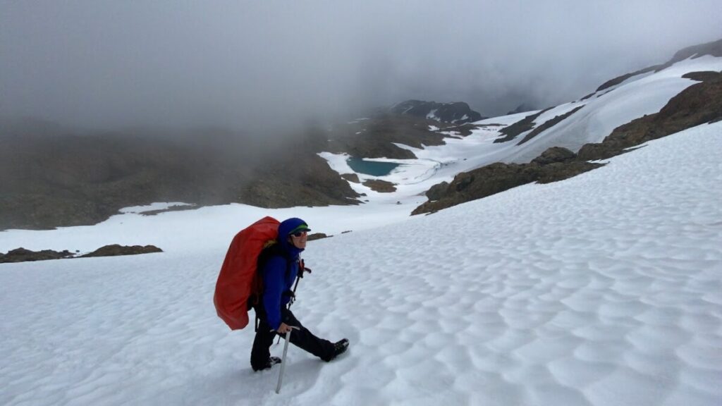
As we climbed, the skies started to clear. We could see that we had picked a great way to go.
Before we knew it, we were on Mt. Celeste (2041m).
We knew there was a ridge from here. This time we stuck on rock and kept marching on.
This is when the best and worst parts of the trip happened.
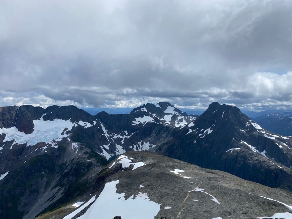
The clouds suddenly lifted. And we could see peaks and glaciers as far as the eye could see. Amazing! I started to feel relaxed and confident.
We were right on schedule. We had finished what we hoped would be our most difficult navigational challenges. We were doing great!
This is right when I heard Erica say, “Oh oh.” It was so quiet it almost didn’t register. I turned our and asked her if she was OK.
She said just twisted her knee a bit. Erica is never injured. She indestructible. So I wasn’t too worried at first. She took some painkillers, wrapped her knee in a tensor bandage. And she kept on marching.
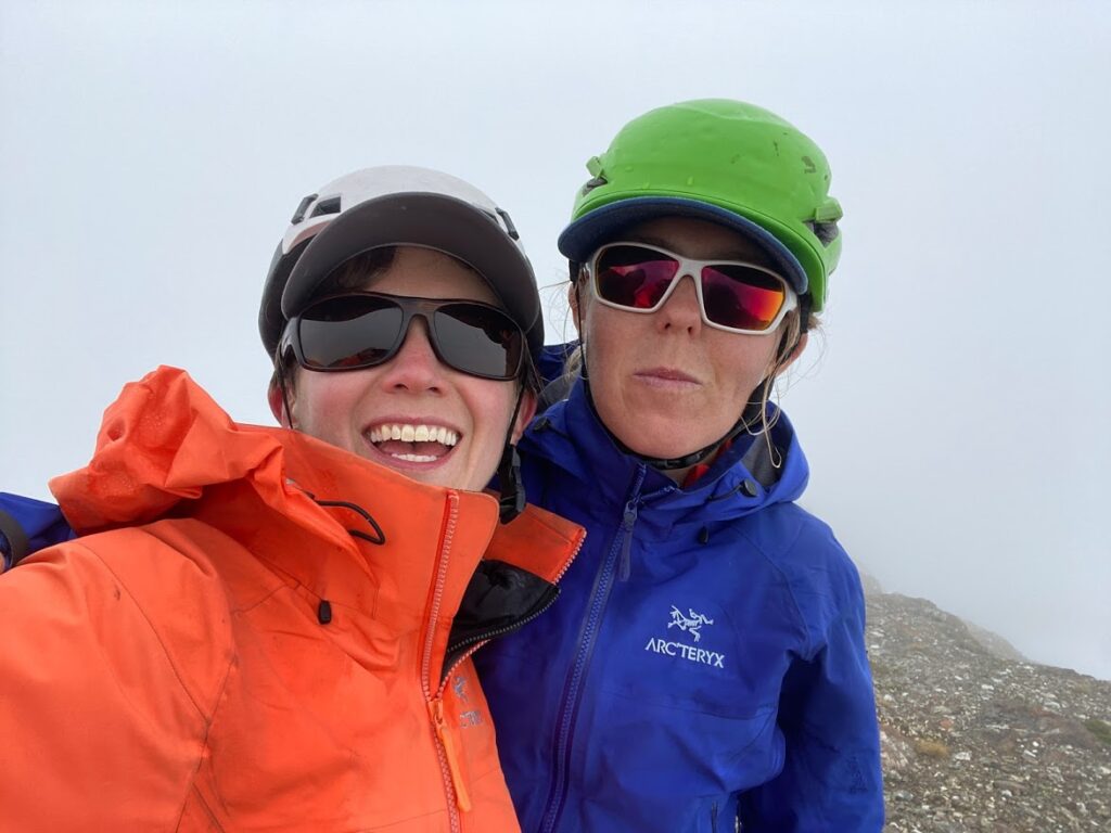
We made it up the other side of Rees Ridge, to Iceberg Peak. This was our seventh mountain of the trip.
Before we lost that elevation, we checked for cell phone coverage. We had already gotten a weather update from our inReach, but we wanted to double check.
And yep, tomorrow’s weather looked horrible. Rain, clouds and wind.
It was OK, though. All we had to do was just get down to our campsite. We could study tomorrow’s our route along the way and make it work, like we always do.
As we started seeing our route for tomorrow, it just looked … bad.
We were supposed to walk around the lake and then up a steep slope on the other side. But there was no snow. The guidebook warned of dangerous conditions with rock fall when the snow was gone. And we were already feel nervous from the rock fall earlier in the trip.
And bad weather was coming.
And Erica was injured.
We decided it was time to switch plans. We decided to go scope out an alternate route. We read the directions from the guidebook on how to get to the other end of the lake. We studied our maps. And off we went.
Every path we tried on this alternate route also looked … bad. Everything was steep. Much steeper than anything we had climbed on this trip.
We carefully searched the side of the mountain, keeping track of where we had looked with our GPS so we didn’t have to double back.
Erica kept driving us forward with dogged determination. She moved faster than I have ever seen her move, scrambling up and down rock faces.
We eventually climbed down a waterfall. It was more difficult than anything we had climbed on this trip so far.
We made it almost to the bottom, but the last bit looked so very steep. We searched for a place where we could rappel, since we had a rope with us. We couldn’t find one.
It was almost dark. 9:00pm.
It felt much too dangerous to try to climb down into the unknown, in the dark while we were so exhausted. We climbed back up the waterfall to find a spot to crash for the night.
Once we were safely in our duct tape tent with warm food in our bellies, we started to process what had happened. And what we were going to do next.
Day 6
We were behind schedule now. But we could skip Harmston, the eighth mountain on our list. And with some long days, we could still make it out on our own.
We just had to get to that next campsite today.
We were quite exhausted from our physical, mental and emotional efforts the day before. But we got ourselves up, dressed in our cold clothes and off we marched into the rain.
We started climbing back down that waterfall. The rain did not improve the steep climbing there. We still couldn’t find a spot to rappel. It was all dead trees and smooth rocks.
So we climbed back up, again. And carefully searched our way all along the side of the ridge.
Nothing felt right.
I have very few photos from this time, as we had decided to only turn on our phones when strictly necessary to conserve battery. We still had more than 50% charge on both phones and our inReach, as well as our backup battery. But we just didn’t know what might happen next.
As a last ditch effort, we decided to go back to our original route and take a closer look. We climbed all the way down to the campsite we thought we were going to reach the night before.
Our plan had been to ditch our heavy packs and do some scouting around the lake.
We sat down to give the route long, hard look. The rain was really starting to come down, and the wind was picking up.
Erica told me she did not feel comfortable going any further. She explained to me the hazards she saw around the lake route.
I saw what she saw, but I felt like it would be OK to go further and check it out. She again said she did not feel comfortable.
I recalled a hypothetical question that Ken Wylie, mountain guide and author, had recently posed on a mountaineering Facebook group we were in: What would you do if you did not feel safe going forward but your friends were pressuring you to? Overwhelmingly the group responded: Your trip partners were jerks and you need better ones!
I do try my best to not to be a jerk. I also love Erica and respect her boundaries. Listening to her was the only option.
We were not going forward. But we also couldn’t go backward.
We were 6 days into an 8 day traverse. We did not have the food turn around. And Erica was injured, even if she wasn’t complaining.
So what could we do?
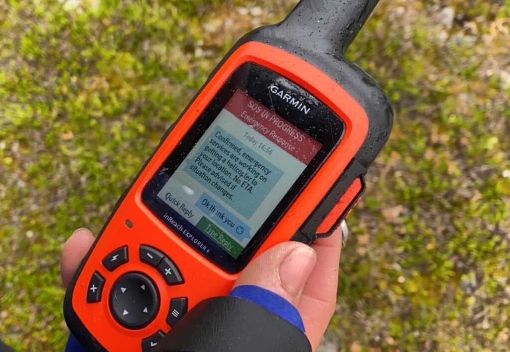
It was time to use our brand new Garmin inReach! We pressed that big old SOS button and started texting with emergency services.
Immediately, our stress levels started to go down. We knew a helicopter was coming, but not when.
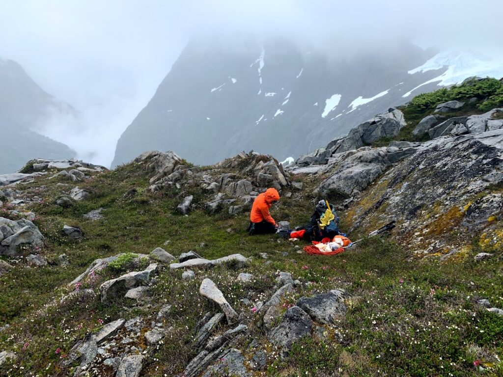
So we got out our stove, and made some tea and soup to warm up and wait for further instructions.
We were pretty sure that no one was coming to get us today in the storm. We told them there was no rush. We had food to stay out here comfortable for two and half more days. We had dry clothes and shelter.
A few hours later, we were texting directly with Campbell River Search and Rescue. They double checked that we would be OK spending another night out. And we were. And they said they’d come to get us at 9:00am the next day.
We set up our tent. Erica’s knee was really starting to hurt and she was having trouble walking.
We enjoyed a Canadian feast of mashed potatoes, gravy and cheese.
We woke up in the middle of the night to hear something clomping around our tent. It sounded like hooves on rock. One last encounter with an elk, perhaps!
Day 7
We got up early and hiked back up the ridge a few hundred meters, so the helicopter would have better spaces to land. From my experience, finding a big clear landing spot was a huge priority for helicopter landings.
But we could have just stayed put. This pilot could have landed just about anywhere.
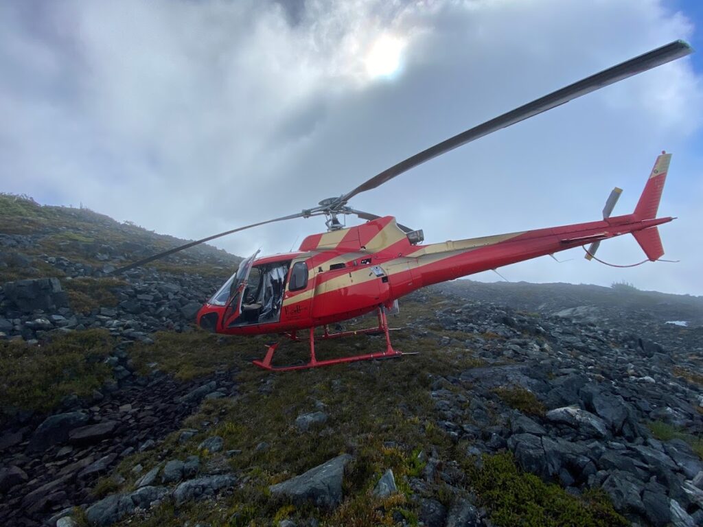
Three volunteers and a pilot got out of the helicopter. We told the SAR volunteers our story. We thanked everyone for coming to help us. They seemed pretty happy to be out enjoying the sights on a beautiful, sunny Saturday. And surprised at just how far we had made it into the park!
We got in the helicopter with our supplied face masks. And we got dropped off near our car at Mt. Washington.
Erica at this point needed hiking poles to hop along. I was so glad to be out of the backcountry!
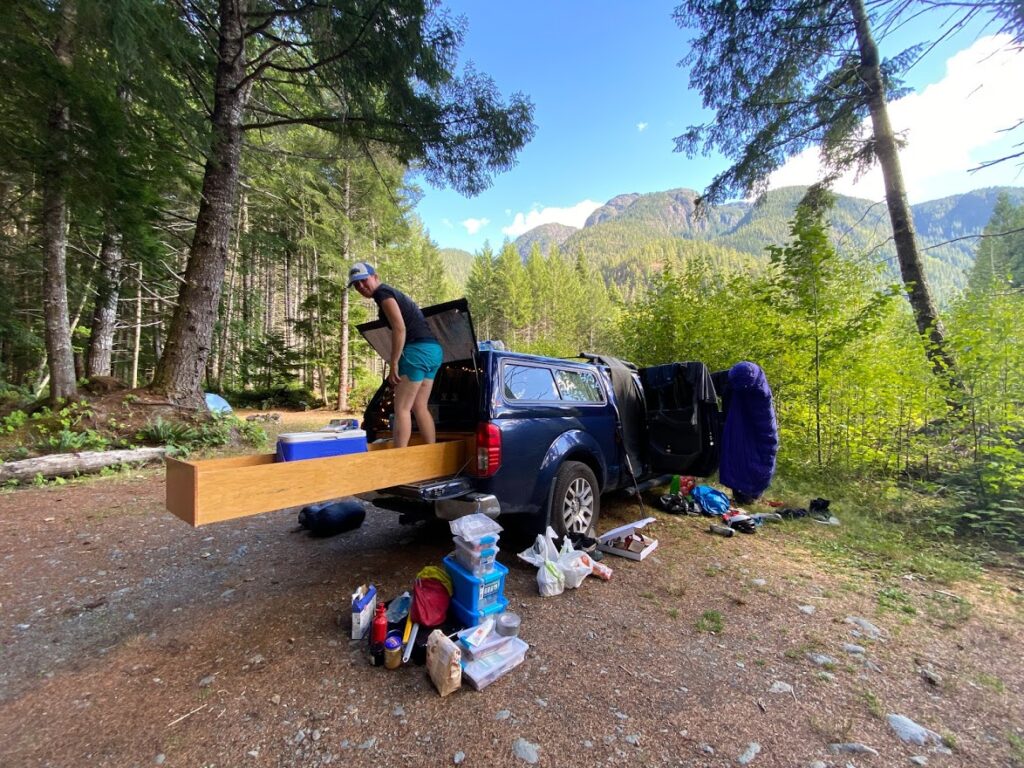
We were way too exhausted to drive home. So we went to our home away from home, a secret camping spot outside of the park. We cleaned up our soggy gear, ate some mac and cheese, and slept for 16 hours.
Reflections
We definitely underestimated this type of traverse on the island. We knew it would be challenging and rugged terrain. But we thought it would be a bit more like backpacking with some scrambling and navigation mixed in.
Instead it was day after day of mountaineering, and long days at that. And when we are mountaineering, we don’t always make it! Usually we can just turn around and head home. But not on this traverse.
We should have researched and mapped out many more alternative routes, so we had a better chance of getting out on our own.
But would that have made much of a difference in this case? I am not sure.
We had so many challenges on this trip. A broken tent. Rock fall. Heat. White outs. Difficulty navigating. A twisted knee. More bad weather.
We successfully dealt with most of them. But at a certain point, there were just too many problems. And we needed help.
It’s been almost two weeks, and Erica is still limping. I think she would have marched on without complaint. But I am very grateful that she did not get that chance.
I am very proud that we called for a rescue when we did, before things were a crisis. We saw the emergency coming and we asked for help with time for SAR to plan. We had the resources to safely wait for someone to come rescue us.
We’ve also done some research on the routes where we got stuck. We understand how people have navigated this terrain and what conditions are more favourable. We hope we can come back to this area again, bringing the lessons we have learned, and try again.
Leave a Reply