Update: This post was written in 2011 and a lot has changed since then. This park is now called the Sooke Hills Wilderness Regional Park. Leaving the original post up for archival reasons.
We started off with directions from the ever helpful guide on summitpost for Mt McDonald.
We parked at the trailhead for Mt Wells, which being part of a regional park, has a parking lot. Mt McDonald, though right across the road, is part of the watershed area. There are no parking lots or official trails for this mountain. Just the way we like it!
We walked about 500 meters from the parking lot south on Humpback Road until we found an unmarked and well worn path, which would lead us up Mt McDonald.
Unfortunately, we came across not one, but two animal skeletons within the first 10 minutes. This was slightly unnerving.
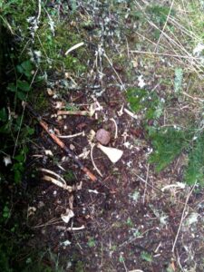
I do prefer my skeletons sightings in the afternoon, after I’ve had a chance to let my coffee digest a little. Here’s hoping it was some deer that are keeping the wolves and cougar nice and full (and disinterested in hikers).
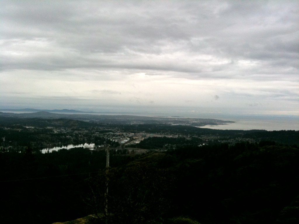
The climbing was pretty steep right away, but the views made it well worth the effort. The path was very clearly worn, making the usual searching for tape and blazes unnecessary.
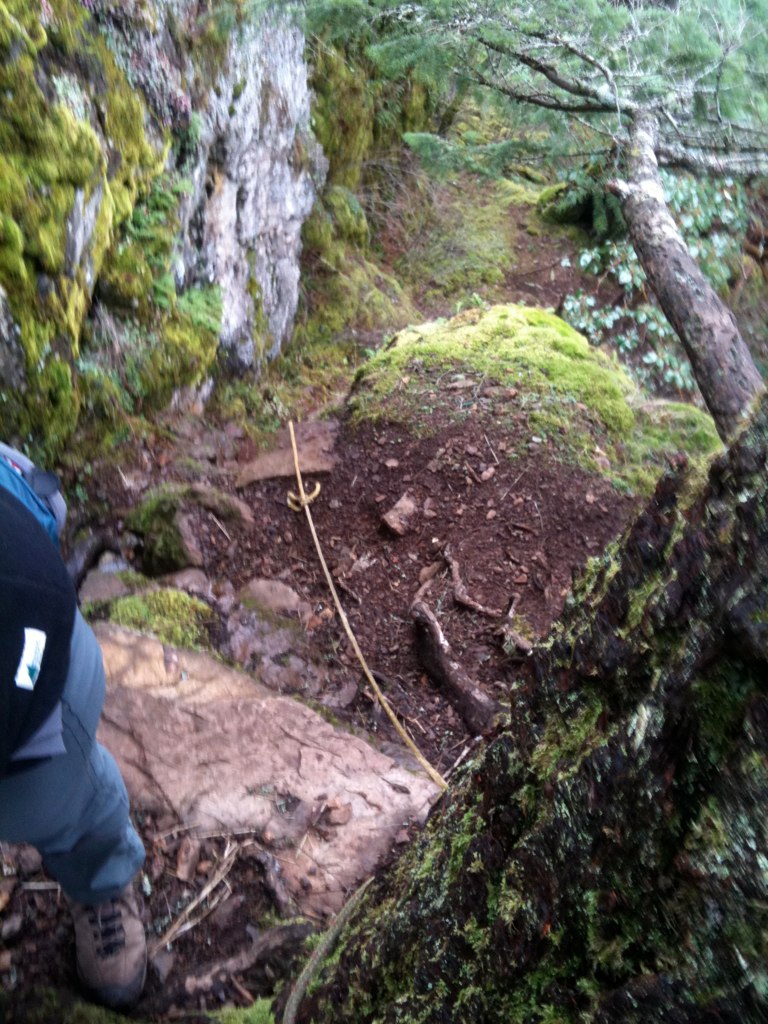
Near the top, friendly hikers had secured ropes to help others get up the steepest parts.
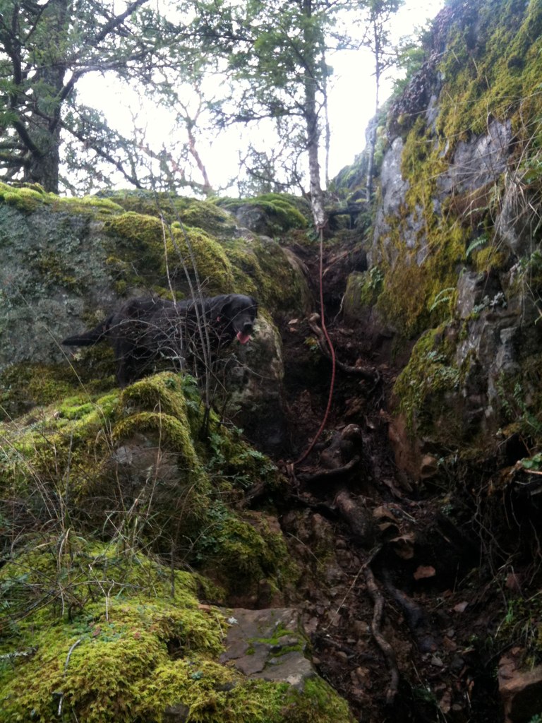
Penny, the adventure dog, was none too pleased about having to be pulled and pushed up the near vertical parts. But she survived without too much indignity.
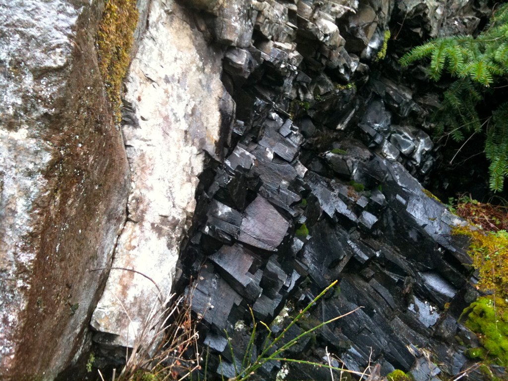
There were some awesome rocks, plants, and little tiny waterfalls.
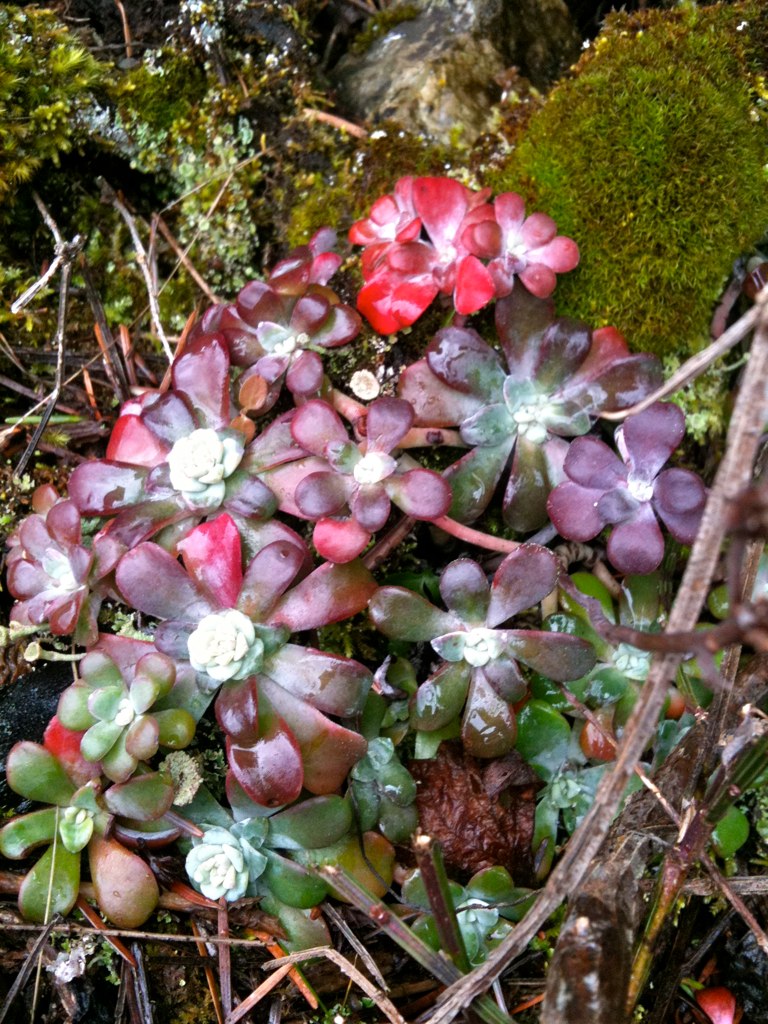
(I was way too into the little tiny waterfalls to take pictures, sorry!)
It took about an hour and a half to get to the summit.
Besides the beautiful views, there were also quite a lot of towers, buildings, and other equipment all protected by a barbed wire fence. The sign said it was meteorological equipment.
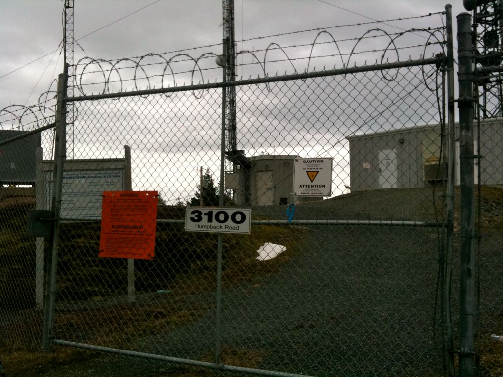
Of course all that equipment meant one thing — an access road! We decided to follow the road down, as from our maps, it seemed like a shortcut back to the car.
The other side of the mountain still had little piles of snow along the road, which was surprising.
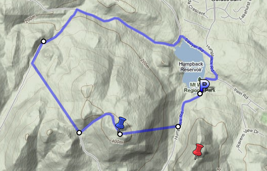
This road did eventually lead us back down to the car, but it took quite a while. The road we took ended up not being the one on our map — perhaps it was too new. The blue pin is Mt McDonald, the red pin is Mt Wells and the P is where our car was. The blue line is my best guess for the the extremely circuitous path we took. Certainly not a shortcut.
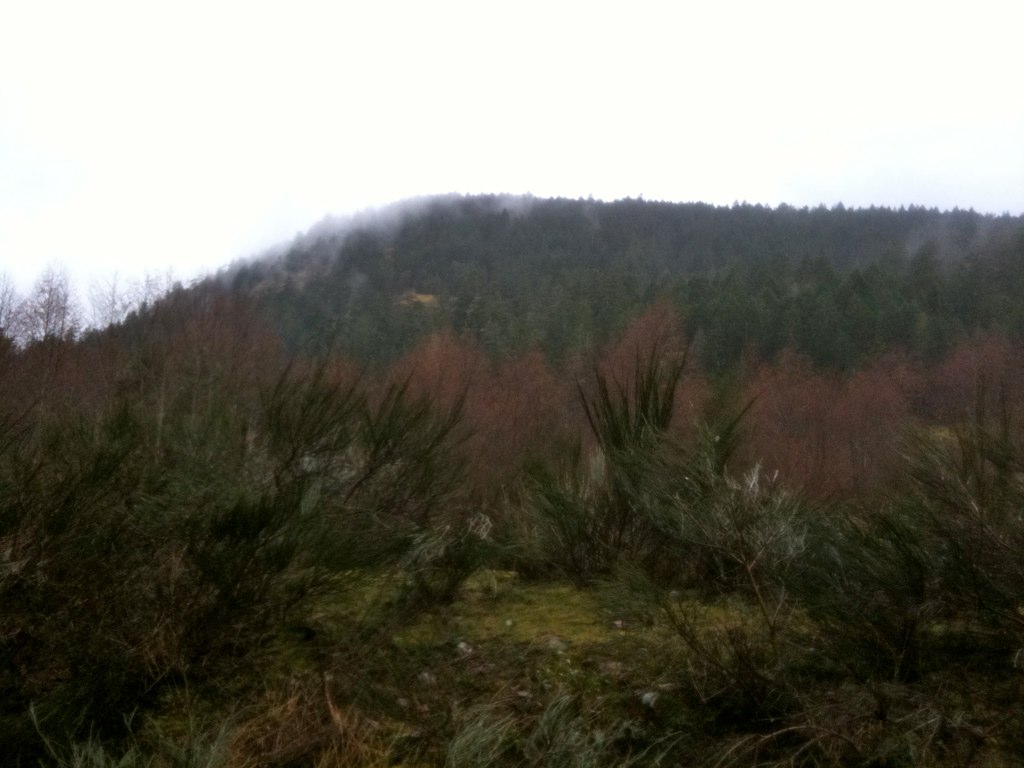
Here’s a shot of Mt McDonald from the side on one of these access roads. Not too impressive looking. But my aching thighs are reminding me that it was over 400 meters tall.
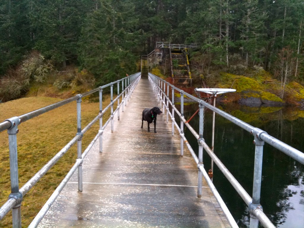
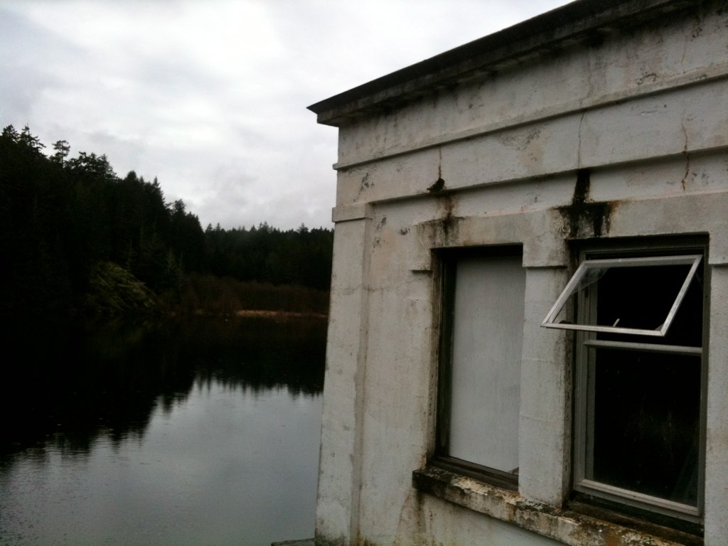
The access road took us to the Humpback Reservoir, which until recently was part of Victoria’s water supply. In 1995, this reservoir was polluted by feces from wild cats giving 100 Victorians toxoplasmosis. (We now get our water from another reservoir.)
This concrete flowline used to carry water Sooke Lake to this reservoir, where it was then transported to Victoria in underground pipes.
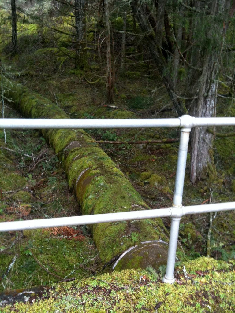
I’ve seen parts of this historic flowline in other parts of Sooke, so it was neat to see where it ends.
The reservoir was right next to the parking lot, so we had thankfully found our way home. Safe and sound and only a little bit damp from the never ending west coast rains.
Leave a Reply